
 quiet
quiet
- Swell period
- 8s
- Wind
- E 28 km/h
- Score
- 5
- Confidence
- 85%
All spots / Maui
November — March
Jaws / Peʻahi
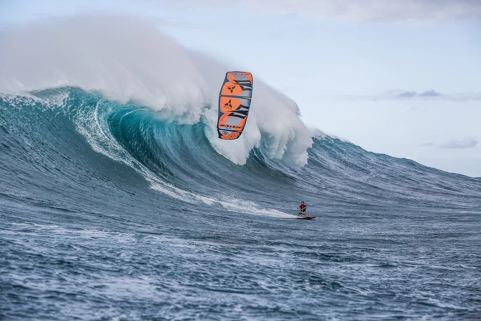
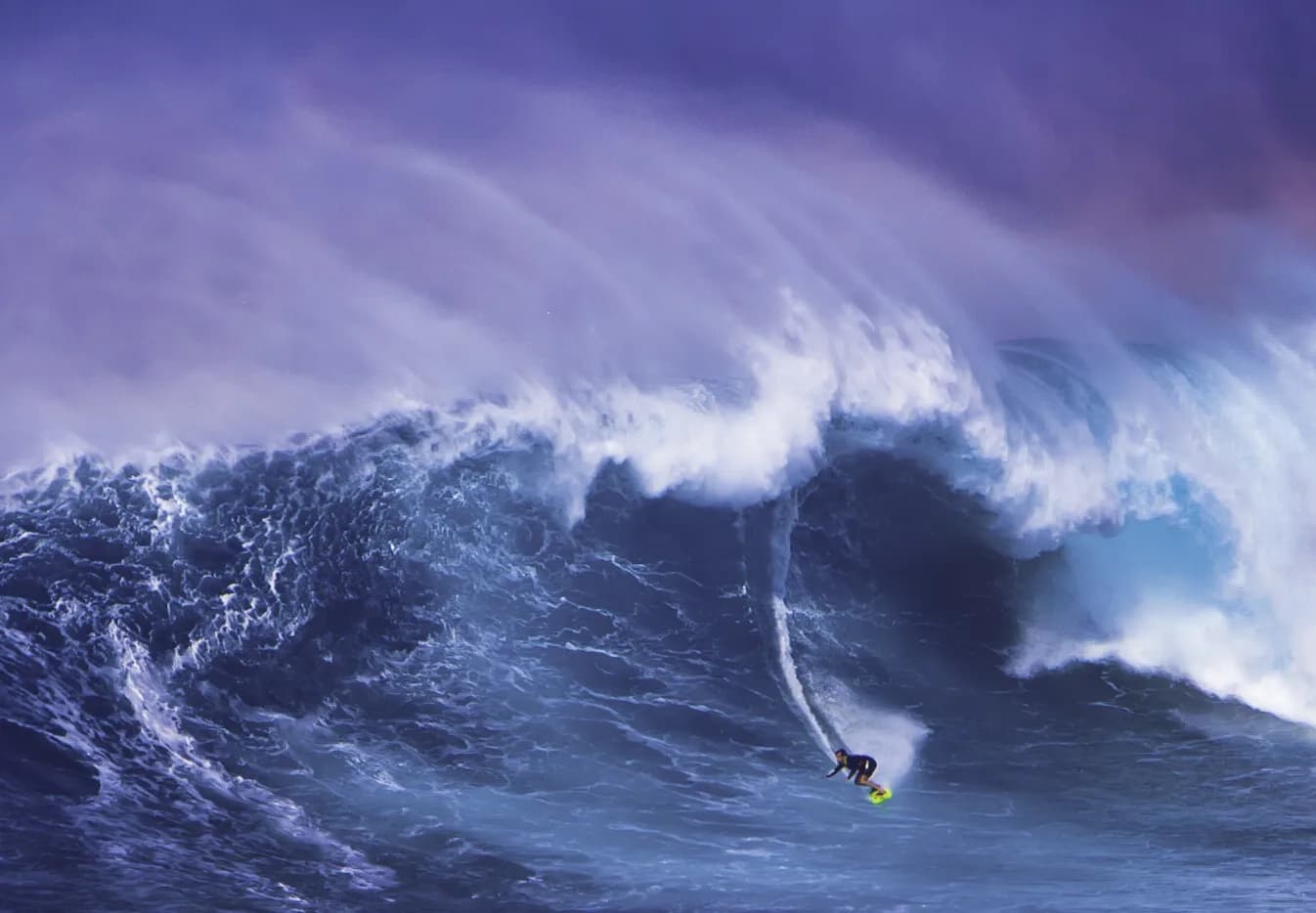
A North Pacific proving ground where clean winter swells turn into fast, mountainous walls.
quiet
Valid 2026-09-04
5Wave score
Forecast confidence85%
At a glance
The latest outlook for Jaws / Peʻahi
No major big-wave window is confirmed yet. We are monitoring the next long-period pulse.
Wave face1.2–1.9 m
Swell period8s
WindE 28 km/h
Confidence85%
Location
Where is Jaws / Peʻahi?
Explore the surrounding coastline and open the marker for location details.
- Jaws / Peʻahi: 20.944, -156.3
See the break
Explore the area
What to do in Jaws / Peʻahi
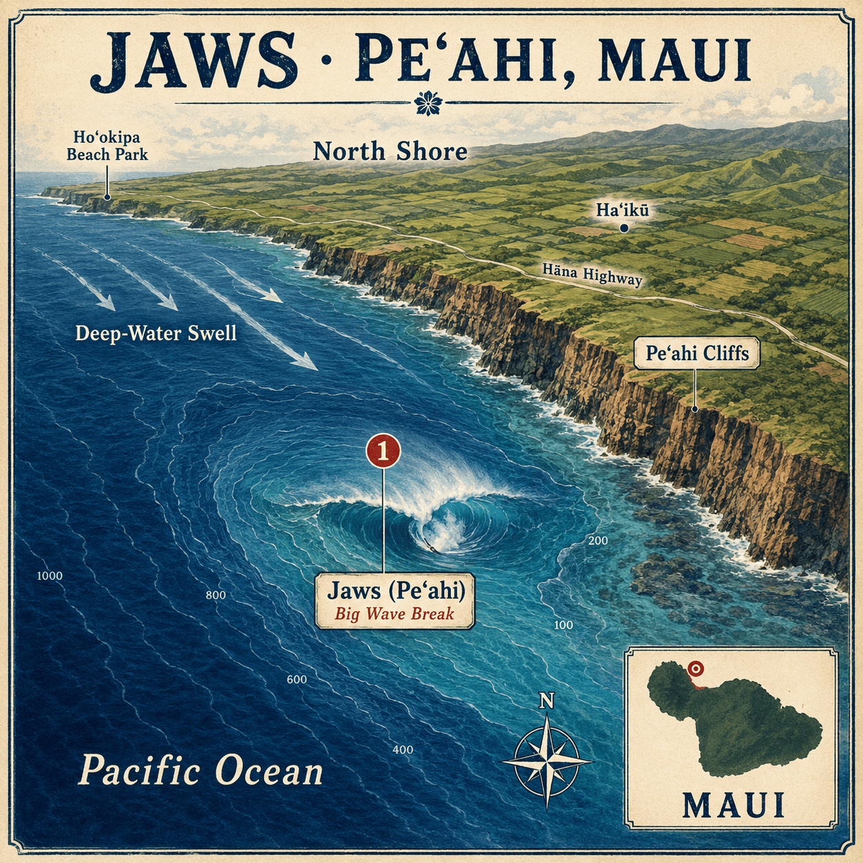
Use the illustrated map to discover beaches, viewpoints and local landmarks.
Jaws (Peʻahi)
One of the world’s most powerful big-wave surf breaks, located just offshore from Maui’s rugged north coast.
Big Wave Break
Deep-ocean swells rise sharply over the underwater reef, producing exceptionally large, fast-moving waves.
Peʻahi Cliffs
Steep coastal cliffs overlooking the break and forming its dramatic landward backdrop.
Deep-Water Swell
Powerful open-ocean energy approaches from the north before reaching the shallower reef at Jaws.
Pacific Ocean
The vast body of water supplying the long-period swells that make Maui’s big-wave conditions possible.
North Shore
Maui’s exposed northern coastline, renowned for powerful surf, strong trade winds, and rugged scenery.
Haʻikū
A lush inland community situated above the Peʻahi coastline and close to the Jaws surf break.
Hāna Highway
The main coastal route running through northern Maui and connecting the communities surrounding Peʻahi.
Ho‘okipa Beach Park
A celebrated surfing and windsurfing location farther west along Maui’s north shore.
Maui
The Hawaiian island where Jaws sits offshore from the remote Peʻahi coastline.
Wave face
Swell history & forecast
Recent results and the next 16 days, shown against stacked 1.8 m people for scale.
Next 16 days
- Swell period
- 14s
- Wind
- E 40 km/h
- Score
- 8
- Confidence
- 78%
- Swell period
- 8s
- Wind
- E 22 km/h
- Score
- 5
- Confidence
- 75%
- Swell period
- 9s
- Wind
- E 32 km/h
- Score
- 5
- Confidence
- 65%
- Swell period
- 8s
- Wind
- E 31.5 km/h
- Score
- 5
- Confidence
- 65%
- Swell period
- 9s
- Wind
- E 28 km/h
- Score
- 5
- Confidence
- 60%
- Swell period
- 9s
- Wind
- E 24 km/h
- Score
- 8
- Confidence
- 45%
- Swell period
- 8.5s
- Wind
- E 26 km/h
- Score
- 10
- Confidence
- 42%
- Swell period
- 8.5s
- Wind
- E 28 km/h
- Score
- 10
- Confidence
- 30%
- Swell period
- 9s
- Wind
- E 28 km/h
- Score
- 15
- Confidence
- 30%
- Swell period
- 8.5s
- Wind
- E 26 km/h
- Score
- 10
- Confidence
- 35%
- Swell period
- 9s
- Wind
- E 28 km/h
- Score
- 10
- Confidence
- 18%
- Swell period
- 8.5s
- Wind
- E 24 km/h
- Score
- 10
- Confidence
- 25%
- Swell period
- 10s
- Wind
- E 24 km/h
- Score
- 15
- Confidence
- 20%
- Swell period
- 8s
- Wind
- E 28 km/h
- Score
- 12
- Confidence
- 25%
- Swell period
- 9s
- Wind
- E 24 km/h
- Score
- 10
- Confidence
- 25%
When to visit
Month-by-month season planner
Typical big-wave season: November — March. Forecasts still decide the worthwhile days.
- Jan2.4 mAverage swellTypical 1.3–3.8 mBig-wave season
- Feb2.3 mAverage swellTypical 1.2–3.6 mBig-wave season
- Mar2.2 mAverage swellTypical 1.2–3.5 mBig-wave season
- Apr2.0 mAverage swellTypical 1.1–3.2 mShoulder month
- May1.8 mAverage swellTypical 0.9–2.8 mUsually quieter
- Jun1.7 mAverage swellTypical 0.9–2.7 mUsually quieter
- Jul1.7 mAverage swellTypical 0.9–2.7 mUsually quieter
- Aug1.8 mAverage swellTypical 0.9–2.8 mUsually quieter
- Sep1.9 mAverage swellTypical 1.0–3.0 mUsually quieter
- Oct2.0 mAverage swellTypical 1.1–3.2 mShoulder month
- Nov2.2 mAverage swellTypical 1.2–3.5 mBig-wave season
- Dec2.4 mAverage swellTypical 1.3–3.8 mBig-wave season
Offshore significant wave height (Hs). Typical range is P10–P90, not breaking wave-face height.
- Confidence
- High
- Estimated uncertainty
- ±0.2 m
Plan the journey
How to reach Jaws / Peʻahi
Travel times are estimates and can increase with traffic, weather, border formalities or major swell crowds.
Big-wave access warning
Final lineup access requires professional big-wave experience, local knowledge and a coordinated safety team when conditions are large.
Kahului Airport (OGG)
Maui’s principal airport is the closest major gateway to the north shore.
Kahului Airport → Haʻikū or Pāʻia
Collect a rental car and drive east along the Hāna Highway. Haʻikū is the closest practical base; Pāʻia offers more restaurants and services.
Travel detailsHaʻikū or Pāʻia
There is no conventional visitor accommodation at Peʻahi. Haʻikū is closest, while Pāʻia is generally 10–15 minutes farther west.
Accommodation → North-shore launch site
Meet the local surf and safety crew at an agreed launch such as Maliko Gulch. Timing depends on the chosen base and sea conditions.
Launch site → Jaws lineup
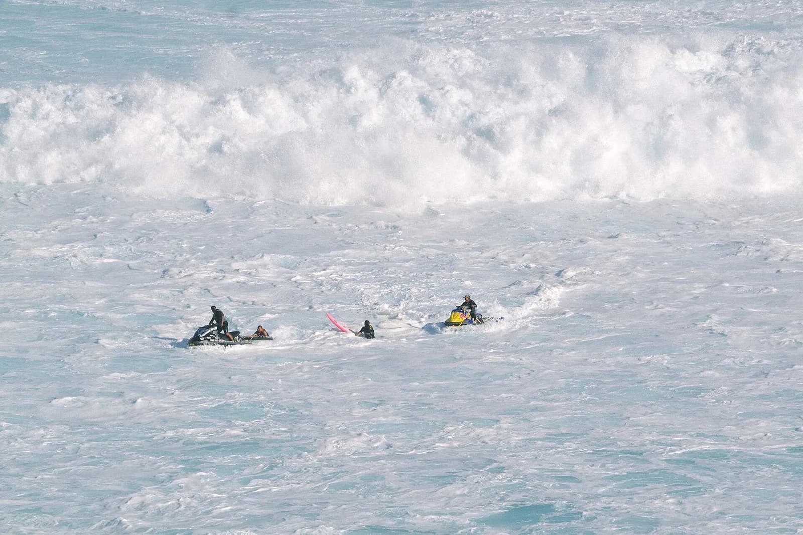
Serious days require a ski with rescue sled, experienced driver, radio communications and a coordinated recovery plan. A support boat may also be used.
Travel detailsHāna Highway → Peʻahi cliff lookout
An unsealed road between mile markers 13 and 14 can require four-wheel drive, followed by a walk. Do not block roads or enter private property.
Guides
Plan the whole visit
Forecast, viewing, travel and safety guidance in one place.
When to visit
Plan flexibly
The established big-wave season at Jaws / Peʻahi is November — March. The best days are uncommon and usually become clear only a few days ahead.
Read guide →Where to watchGive the ocean room
View Jaws / Peʻahi from established public viewpoints and obey closures, barriers and local authorities.
Read guide →Where to stayTravel with flexibility
Stay within easy reach of Jaws / Peʻahi, but avoid booking solely around a long-range forecast.
Read guide →SafetyNon-negotiable basics
Big-wave coastlines are hazardous for spectators and surfers. Conditions at Jaws / Peʻahi can change quickly.
Read guide →RecordsVerified history first
Jaws / Peʻahi has earned its place in big-wave history through remarkable conditions, surfers and local communities.
Read guide →Common questions
Jaws / Peʻahi FAQs
Practical answers for planning a safe, well-informed visit.
When does Jaws usually break?+
Jaws is most active during Maui’s North Pacific winter swell season, typically from November through March. It requires a large, well-directed swell to begin showing its full scale.
Where is Jaws on Maui?+
Jaws, also called Peʻahi, lies offshore from Maui’s rugged north coast near Haʻikū. The closest practical accommodation bases are Haʻikū and Pāʻia.
How do surfers reach Jaws?+
Serious surf teams normally use a jet ski with a rescue sled or a support boat from an agreed north-shore launch. Jaws is not a normal visitor paddle-out.
Can spectators watch Jaws from land?+
A cliff lookout can be reached from an unsealed road off Hāna Highway, sometimes requiring four-wheel drive and a walk. Visitors must avoid private property and keep access roads clear.