
 big
big
- Swell period
- 16s
- Wind
- NW 20 km/h
- Score
- 78
- Confidence
- 60%
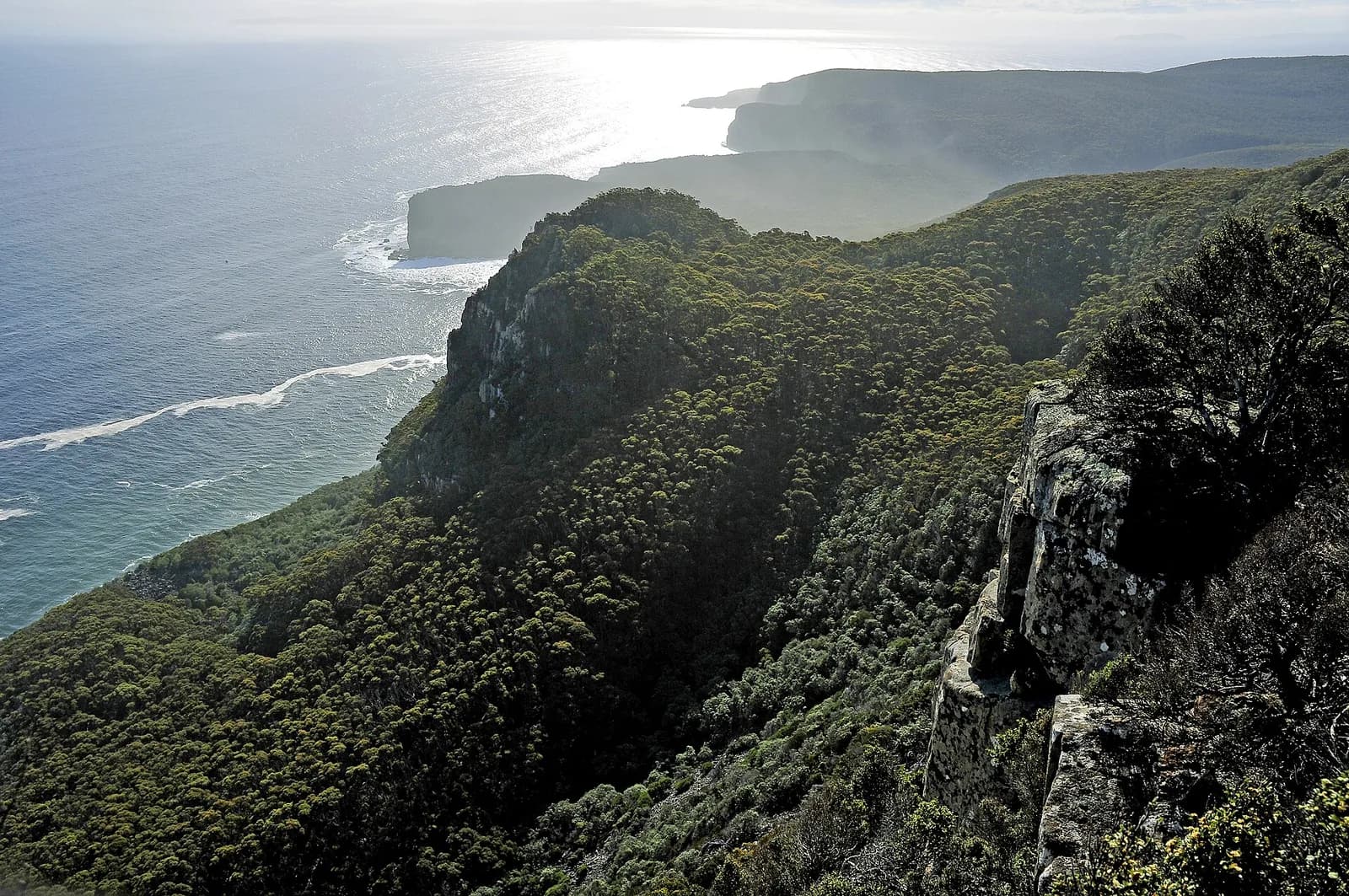
All spots / Tasmania
March — September
Shipstern Bluff
A remote Tasmanian slab where deep-water swell folds over a stepped reef beneath towering cliffs.
big
Valid 2026-09-04
78Wave score
Forecast confidence60%
At a glance
The latest outlook for Shipstern Bluff
No major big-wave window is confirmed yet. We are monitoring the next long-period pulse.
Wave face3.5–5.5 m
Swell period16s
WindNW 20 km/h
Confidence60%
Location
Where is Shipstern Bluff?
Explore the surrounding coastline and open the marker for location details.
- Shipstern Bluff: -43.22, 147.75
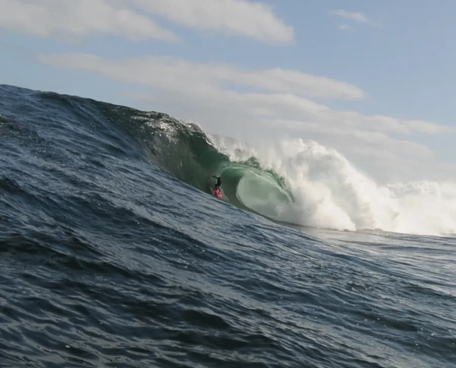
See the break

Explore the area
What to do in Shipstern Bluff
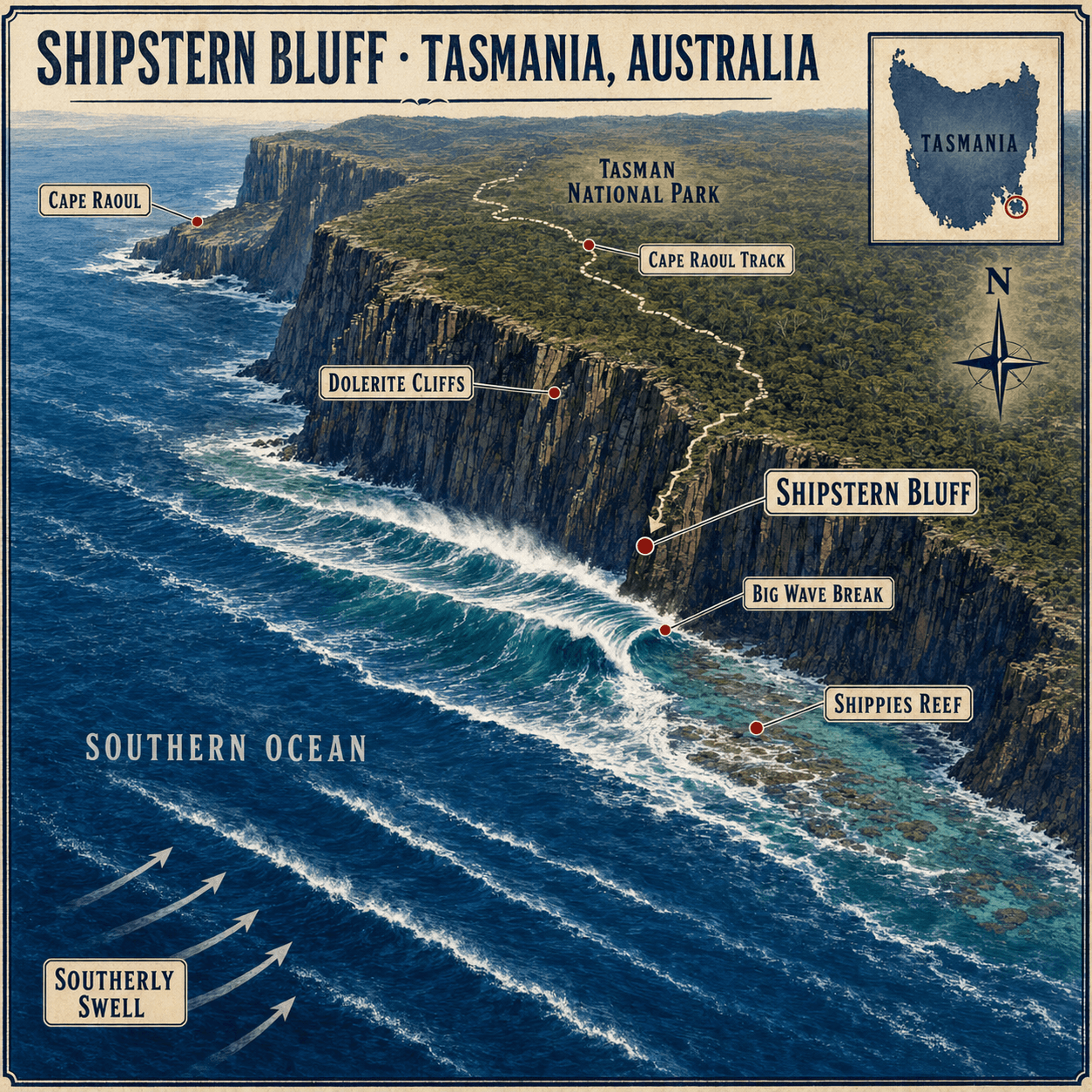
Use the illustrated map to discover beaches, viewpoints and local landmarks.
Shipstern Bluff
A remote big-wave location where enormous Southern Ocean swells break beneath towering sea cliffs.
Big Wave Break
A thick, powerful right-hand wave famous for the unpredictable steps that form across its face.
Shippies Reef
The shallow underwater rock shelf that forces incoming swell upward into Shipstern’s heavy breaking wave.
Dolerite Cliffs
Towering rock columns rising above the break and creating Shipstern’s dramatic natural amphitheatre.
Tasman National Park
A protected coastal wilderness encompassing the cliffs, forests and remote shoreline surrounding Shipstern Bluff.
Cape Raoul Track
A wilderness walking route with a side trail descending toward the coast at Shipstern Bluff.
Cape Raoul
A nearby dolerite headland marking the spectacular southern edge of the Tasman Peninsula.
Southerly Swell
Powerful ocean energy approaches from the south before rising abruptly over the shallow reef.
Southern Ocean
The exposed body of water supplying the cold, powerful swells that make Shipstern Bluff possible.
Tasmania
Australia’s island state and home to Shipstern Bluff on the remote southern Tasman Peninsula.
Wave face
Swell history & forecast
Recent results and the next 16 days, shown against stacked 1.8 m people for scale.
Next 16 days
- Swell period
- 15s
- Wind
- NW 35 km/h
- Score
- 72
- Confidence
- 78%
 watch
watch- Swell period
- 15s
- Wind
- N 18.5 km/h
- Score
- 72
- Confidence
- 65%
- Swell period
- 13s
- Wind
- NW 22 km/h
- Score
- 35
- Confidence
- 62%
- Swell period
- 15s
- Wind
- NW 20 km/h
- Score
- 38
- Confidence
- 60%
- Swell period
- 18s
- Wind
- W 32 km/h
- Score
- 82
- Confidence
- 55%
- Swell period
- 16s
- Wind
- W 32 km/h
- Score
- 74
- Confidence
- 55%
- Swell period
- 15s
- Wind
- W 28 km/h
- Score
- 62
- Confidence
- 48%
- Swell period
- 14s
- Wind
- W 28 km/h
- Score
- 42
- Confidence
- 35%
- Swell period
- 13.5s
- Wind
- NW 22 km/h
- Score
- 28
- Confidence
- 40%
- Swell period
- 14s
- Wind
- NW 18 km/h
- Score
- 28
- Confidence
- 30%
- Swell period
- 14.5s
- Wind
- N 24 km/h
- Score
- 45
- Confidence
- 25%
- Swell period
- 15s
- Wind
- N 22 km/h
- Score
- 58
- Confidence
- 28%
- Swell period
- 14s
- Wind
- NW 24 km/h
- Score
- 45
- Confidence
- 25%
- Swell period
- 15s
- Wind
- NW 28 km/h
- Score
- 58
- Confidence
- 28%
- Swell period
- 14.5s
- Wind
- NW 26 km/h
- Score
- 48
- Confidence
- 25%
When to visit
Month-by-month season planner
Typical big-wave season: March — September. Forecasts still decide the worthwhile days.
- Jan2.8 mAverage swellTypical 1.5–4.4 mUsually quieter
- Feb2.7 mAverage swellTypical 1.4–4.3 mShoulder month
- Mar2.8 mAverage swellTypical 1.5–4.4 mBig-wave season
- Apr3.1 mAverage swellTypical 1.6–4.9 mBig-wave season
- May3.4 mAverage swellTypical 1.8–5.4 mBig-wave season
- Jun3.6 mAverage swellTypical 1.9–5.7 mBig-wave season
- Jul3.7 mAverage swellTypical 1.9–5.9 mBig-wave season
- Aug3.6 mAverage swellTypical 1.9–5.7 mBig-wave season
- Sep3.4 mAverage swellTypical 1.8–5.4 mBig-wave season
- Oct3.2 mAverage swellTypical 1.7–5.1 mShoulder month
- Nov3.0 mAverage swellTypical 1.6–4.7 mUsually quieter
- Dec2.8 mAverage swellTypical 1.5–4.4 mUsually quieter
Offshore significant wave height (Hs). Typical range is P10–P90, not breaking wave-face height.
- Confidence
- Medium
- Estimated uncertainty
- ±0.4 m
Plan the journey
How to reach Shipstern Bluff
Travel times are estimates and can increase with traffic, weather, border formalities or major swell crowds.
Big-wave access warning
Final lineup access requires professional big-wave experience, local knowledge and a coordinated safety team when conditions are large.
Hobart Airport (HBA)
Hobart is the nearest major airport to the Tasman Peninsula.
Hobart Airport → Tasman Peninsula
Follow the Arthur Highway through Sorell, Dunalley and Eaglehawk Neck toward Port Arthur, Nubeena or the chosen base.
Travel detailsPort Arthur, Nubeena or Eaglehawk Neck
Port Arthur has the broadest accommodation selection, Nubeena is closer to the trailhead, and Eaglehawk Neck can suit boat access.
Accommodation → Launch point or trailhead
Surf teams meet a pre-arranged marine crew. Walkers use Stormlea Road near Nubeena to reach the Cape Raoul/Shipstern trailhead.
Peninsula launch → Shipstern Bluff
The marine route is roughly 30 kilometres. Surfers enter from a boat or ski because there is no sensible casual shoreline paddle.
Travel detailsCape Raoul trailhead → Shipstern Bluff
The overland route suits viewing and photography, but carrying big-wave equipment is generally less practical than organised marine access.
Travel detailsRemote-area preparation
Teams need redundant communications, medical equipment, sufficient fuel and a recovery plan for rapidly changing Southern Ocean weather.
Guides
Plan the whole visit
Forecast, viewing, travel and safety guidance in one place.
When to visit
Plan flexibly
The established big-wave season at Shipstern Bluff is March — September. The best days are uncommon and usually become clear only a few days ahead.
Read guide →Where to watchGive the ocean room
View Shipstern Bluff from established public viewpoints and obey closures, barriers and local authorities.
Read guide →Where to stayTravel with flexibility
Stay within easy reach of Shipstern Bluff, but avoid booking solely around a long-range forecast.
Read guide →SafetyNon-negotiable basics
Big-wave coastlines are hazardous for spectators and surfers. Conditions at Shipstern Bluff can change quickly.
Read guide →RecordsVerified history first
Shipstern Bluff has earned its place in big-wave history through remarkable conditions, surfers and local communities.
Read guide →Common questions
Shipstern Bluff FAQs
Practical answers for planning a safe, well-informed visit.
Where is Shipstern Bluff?+
Shipstern Bluff lies on the remote southern Tasman Peninsula in Tasmania, Australia, within the coastal wilderness of Tasman National Park.
How do surfers reach Shipstern Bluff?+
Professional surf teams normally use a pre-arranged boat or jet ski from a suitable Tasman Peninsula launch. There is no sensible casual shoreline paddle route.
Can visitors hike to Shipstern Bluff?+
Yes. The overland route from the Cape Raoul and Shipstern trailhead generally takes 3 to 4.5 hours return. It is useful for viewing but demanding for carrying surf equipment.
Is Shipstern Bluff suitable for beginners?+
No. It is an isolated, cold-water slab with a shallow reef, enormous power and unpredictable steps in the wave face. Professional experience and redundant safety systems are essential.