
 quiet
quiet
- Swell period
- 15s
- Wind
- NW 20 km/h
- Score
- 25
- Confidence
- 68%
All spots / Mexico
November — March
Todos Santos
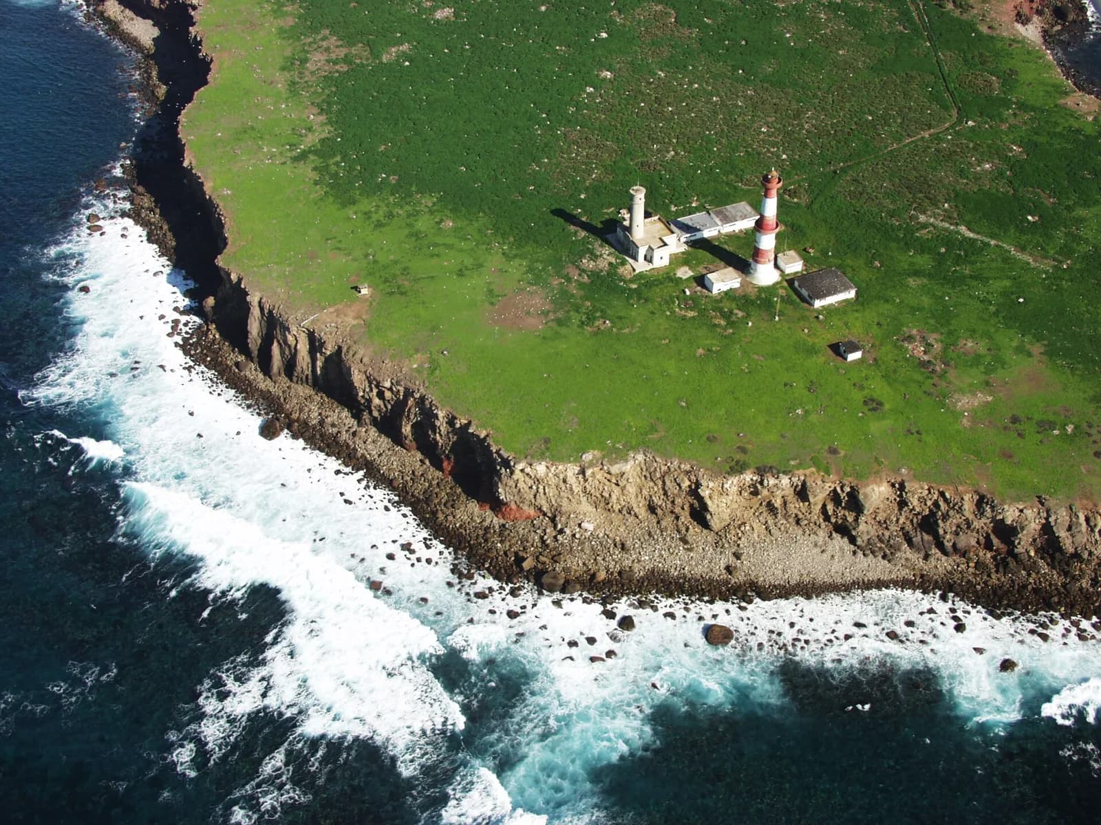
The remote Killers reef turns open-ocean winter swell into enormous, fast-moving peaks.
quiet
Valid 2026-09-04
25Wave score
Forecast confidence68%
At a glance
The latest outlook for Todos Santos
No major big-wave window is confirmed yet. We are monitoring the next long-period pulse.
Wave face1.2–1.8 m
Swell period15s
WindNW 20 km/h
Confidence68%
Location
Where is Todos Santos?
Explore the surrounding coastline and open the marker for location details.
- Todos Santos: 31.797, -116.8
See the break
Explore the area
What to do in Todos Santos
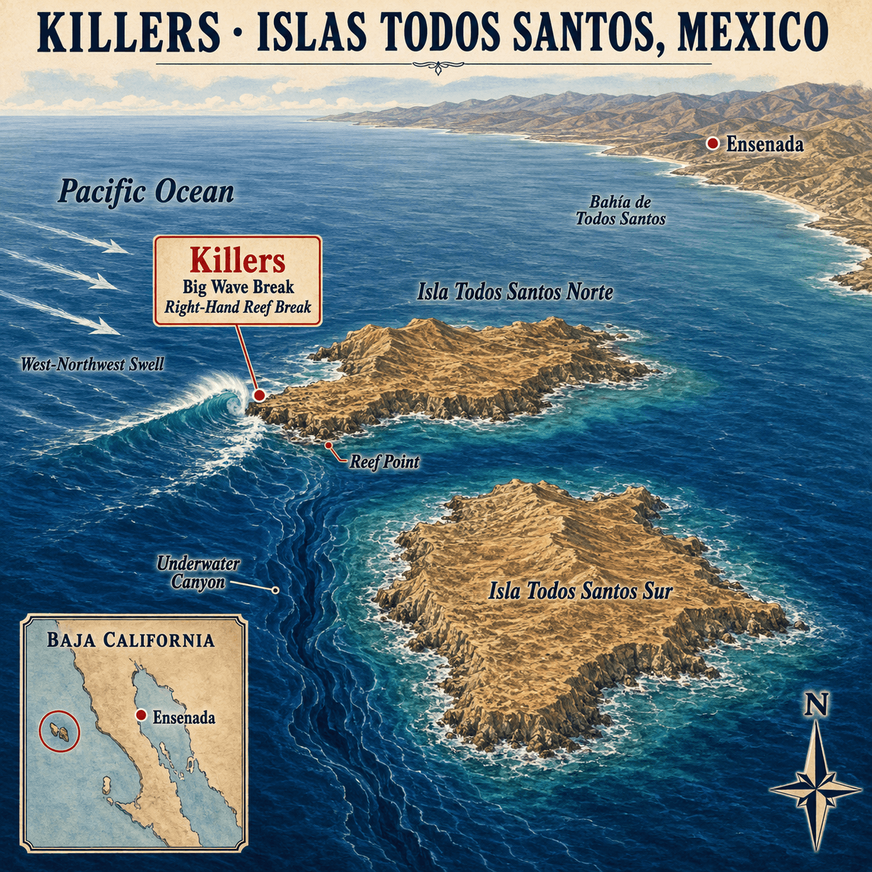
Use the illustrated map to discover beaches, viewpoints and local landmarks.
Killers
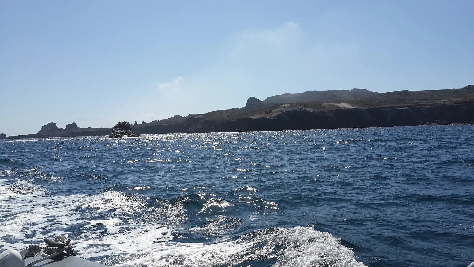
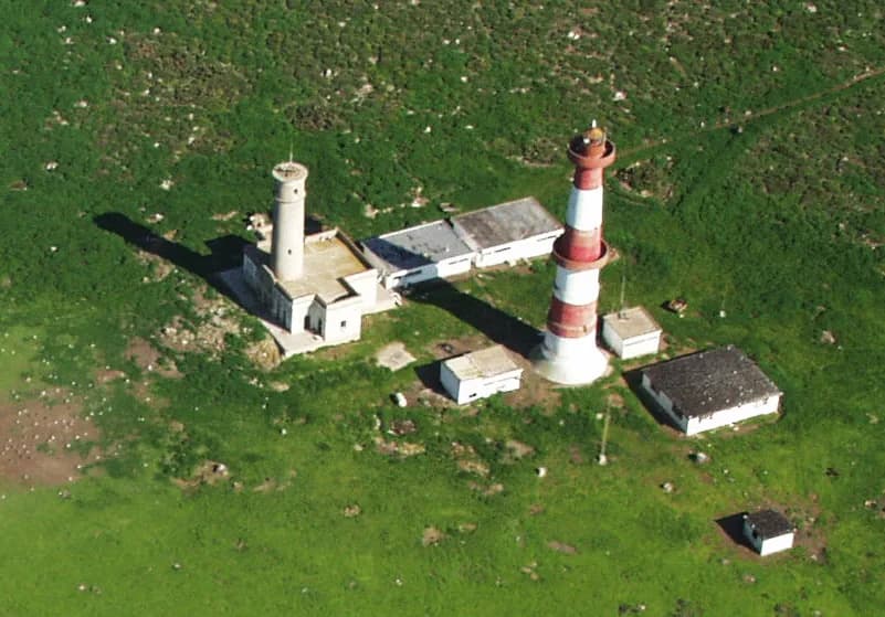
One of Mexico’s most powerful big-wave breaks, located at the exposed western edge of Isla Todos Santos Norte.
Big Wave Break
Large Pacific swells rise over the offshore reef, producing steep drops and exceptionally heavy waves.
Right-Hand Reef Break
The wave breaks right from the island’s rocky point into deep water along the reef.
Reef Point
The exposed western tip of the northern island where incoming swell meets the shallow underwater structure.
Underwater Canyon
A deep seabed feature beside the island that helps direct long-period swell toward the break.
Isla Todos Santos Norte
The smaller northern island and home of the Killers big-wave break.
Isla Todos Santos Sur
The larger southern island forming the second half of the remote Todos Santos island group.
West-Northwest Swell
Powerful ocean energy approaches from the west and northwest before reaching the island’s exposed reef.
Bahía de Todos Santos
The broad coastal bay separating the offshore islands from Ensenada and the Baja California mainland.
Ensenada
The nearest mainland city and the principal departure point for boats travelling to the islands.
Pacific Ocean
The open ocean supplying the powerful winter swells that make Killers a world-class big-wave location.
Baja California
Mexico’s northwestern peninsula and the mainland region closest to Islas Todos Santos.
Wave face
Swell history & forecast
Recent results and the next 16 days, shown against stacked 1.8 m people for scale.
Next 16 days
- Swell period
- 13s
- Wind
- NW 16.5 km/h
- Score
- 18
- Confidence
- 72%
- Swell period
- 14s
- Wind
- NW 18 km/h
- Score
- 18
- Confidence
- 72%
- Swell period
- 14s
- Wind
- NW 13 km/h
- Score
- 28
- Confidence
- 65%
- Swell period
- 14s
- Wind
- NW 18.5 km/h
- Score
- 28
- Confidence
- 55%
- Swell period
- 13s
- Wind
- NW 14 km/h
- Score
- 18
- Confidence
- 45%
- Swell period
- 13s
- Wind
- NW 16 km/h
- Score
- 28
- Confidence
- 45%
- Swell period
- 13s
- Wind
- NW 18 km/h
- Score
- 22
- Confidence
- 35%
- Swell period
- 13s
- Wind
- W 14 km/h
- Score
- 18
- Confidence
- 30%
- Swell period
- 12s
- Wind
- NW 16.5 km/h
- Score
- 22
- Confidence
- 35%
- Swell period
- 13s
- Wind
- NW 18 km/h
- Score
- 28
- Confidence
- 30%
- Swell period
- 13s
- Wind
- NW 18 km/h
- Score
- 18
- Confidence
- 22%
- Swell period
- 13s
- Wind
- NW 18.5 km/h
- Score
- 18
- Confidence
- 28%
- Swell period
- 13s
- Wind
- NW 18 km/h
- Score
- 22
- Confidence
- 20%
- Swell period
- 13s
- Wind
- NW 19 km/h
- Score
- 22
- Confidence
- 18%
- Swell period
- 13s
- Wind
- NW 22 km/h
- Score
- 18
- Confidence
- 25%
When to visit
Month-by-month season planner
Typical big-wave season: November — March. Forecasts still decide the worthwhile days.
- Jan2.4 mAverage swellTypical 1.2–3.9 mBig-wave season
- Feb2.3 mAverage swellTypical 1.1–3.8 mBig-wave season
- Mar2.1 mAverage swellTypical 1.0–3.4 mBig-wave season
- Apr1.8 mAverage swellTypical 0.9–2.9 mShoulder month
- May1.6 mAverage swellTypical 0.8–2.6 mUsually quieter
- Jun1.4 mAverage swellTypical 0.7–2.3 mUsually quieter
- Jul1.3 mAverage swellTypical 0.6–2.1 mUsually quieter
- Aug1.4 mAverage swellTypical 0.7–2.3 mUsually quieter
- Sep1.6 mAverage swellTypical 0.8–2.6 mUsually quieter
- Oct1.9 mAverage swellTypical 0.9–3.1 mShoulder month
- Nov2.2 mAverage swellTypical 1.1–3.6 mBig-wave season
- Dec2.5 mAverage swellTypical 1.2–4.1 mBig-wave season
Offshore significant wave height (Hs). Typical range is P10–P90, not breaking wave-face height.
- Confidence
- Medium
- Estimated uncertainty
- ±0.3 m
Plan the journey
How to reach Todos Santos
Travel times are estimates and can increase with traffic, weather, border formalities or major swell crowds.
Big-wave access warning
Final lineup access requires professional big-wave experience, local knowledge and a coordinated safety team when conditions are large.
Tijuana International Airport (TIJ)
Use Tijuana, not Los Cabos: Killers is offshore from Ensenada, not beside Todos Santos in Baja California Sur.
Tijuana Airport → Ensenada
Travel roughly 110 kilometres south by rental car or pre-booked transfer. Border and traffic conditions can extend the journey.
Travel detailsEnsenada
The islands have no visitor accommodation. Ensenada provides hotels, supplies, marinas and access to suitable charter operators.
Accommodation → Ensenada Harbour
Confirm the departure point, swell, return time, capacity and whether the vessel is equipped to support surfers before boarding.
Ensenada Harbour → Isla Todos Santos
The islands are approximately 12 miles offshore. Vessel speed and sea state determine the crossing time.
Travel detailsSupport vessel → Killers lineup
Surfers transfer from the boat or safety ski outside the danger zone. Pickup signals and the recovery location must be agreed before entry.
Guides
Plan the whole visit
Forecast, viewing, travel and safety guidance in one place.
When to visit
Plan flexibly
The established big-wave season at Todos Santos is November — March. The best days are uncommon and usually become clear only a few days ahead.
Read guide →Where to watchGive the ocean room
View Todos Santos from established public viewpoints and obey closures, barriers and local authorities.
Read guide →Where to stayTravel with flexibility
Stay within easy reach of Todos Santos, but avoid booking solely around a long-range forecast.
Read guide →SafetyNon-negotiable basics
Big-wave coastlines are hazardous for spectators and surfers. Conditions at Todos Santos can change quickly.
Read guide →RecordsVerified history first
Todos Santos has earned its place in big-wave history through remarkable conditions, surfers and local communities.
Read guide →Common questions
Todos Santos FAQs
Practical answers for planning a safe, well-informed visit.
Where is the Killers big-wave break?+
Killers is at Isla Todos Santos Norte, roughly 12 miles offshore from Ensenada, Mexico. It is not beside the town of Todos Santos in Baja California Sur.
How do surfers reach Killers?+
Surfers use a suitable charter boat or safety ski from Ensenada Harbour. The crossing generally takes 40 to 60 minutes, and pickup signals must be agreed before entering the water.
Where should visitors stay for Killers?+
Ensenada is the required mainland base because the islands have no normal visitor accommodation or services. It provides hotels, supplies, marinas and charter operators.
Is Killers suitable for inexperienced surfers?+
No. Killers is a remote, heavy offshore reef requiring professional big-wave ability, local knowledge, marine support and a coordinated rescue and recovery plan.